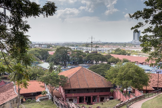
The primary location for forts in Melaka has always been on this hill in the area called Bandar Hilir. From here you can observe activities on both the Melaka River and out to sea in the Straits of Malacca. Today you may know this location as the site of the ruins of St. Paul’s Church, and it is well worth panting up all the steps to get to the top!

Coming down the other side of the hill (with the Melaka Sultanate Palace at the bottom left), you get a good view of what is left of the A Famosa, the former Portuguese fort. But lets take a slight diversion and discuss the fort later.
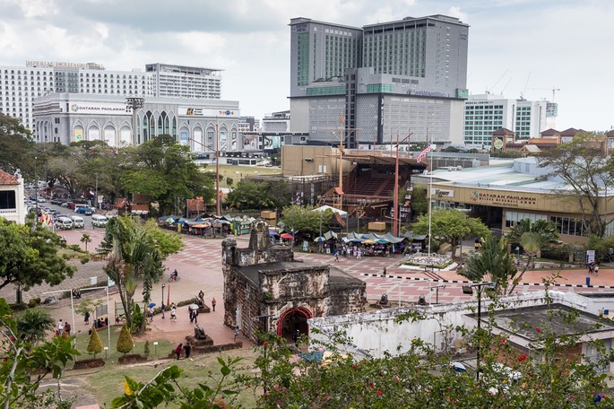
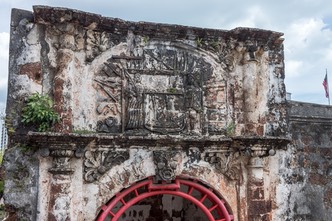
Next to the Santiago Gate (the ruins in the middle of the photo above) is a larged paved area who’s history was lost on me until we got to chatting to a vendor near St. Paul’s Church. This is Merdeka Square (Padang Bandar Hilir) but you will not find it listed as such on the Web. It is also called Padang Pahlawan (Warrior’s Field). On 20th February 1956, the announcement of the date of Independence of the Federation of Malaya was made here. The announcement was made by Tunku Abdul Rahman after returning from talks in London, and it was made on this site as space was needed for the crowd of 50,000 gathered to hear the news. Now you might suppose that such an historic announcement would have been made in Kuala Lumpur, not in Melaka. Well according to this very informative website Tourism Melaka Blogspot , the Tunku chose to announce the date of Merdeka in Melaka because it was where most of the funds raised for his delegation’s trip to England came from. Today this area has shrunk in size and in significance, almost as if they want this bit of history to be forgotten.
Somewhere here is a small obelisk (the Mekdeka Obelisk; sorry I have no photo of this because I was not aware of its existence until returning home) which marks the spot where H.G. Hammet, the last British resident commissioner of Melaka, handed over the instrument of independence to the state’s first local governor, Leong Yew Koh on 31st August, 1957.
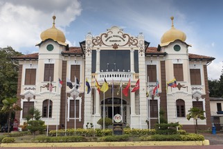
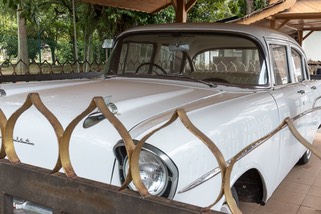
On the left side of the photo above, is the site of the Proclamation of Independence Memorial which currently houses a museum but started life as the Malacca Club, the social centre of British colonial Melaka. And as you walk towards the Melaka Sultanate Palace, you might spot this open garage housing one of the cars used by Tunku Abdul Rahman when touring the country.
So, let’s get back to the fort….. Here is a photo of Melaka on top of which has been marked the outline of Kota Melaka, the Fort of Melaka. It is the area of Bandar Hilir with St. Paul’s Church right in the middle, and the long street of red brick Dutch buildings on the left.
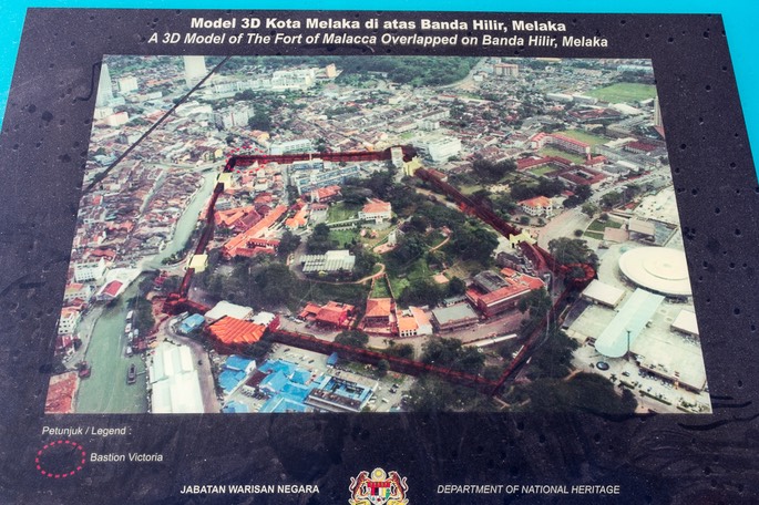
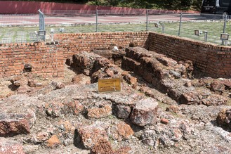
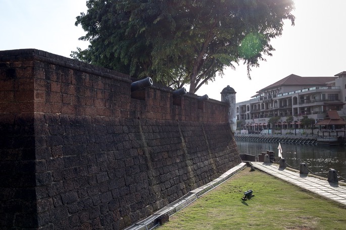
On the left below is the site of the Bastion Victoria near Chan Koon Cheng Bridge (mark as a red dotted circle in the photo above). And on the right is the site of a Dutch Fort, and its alignment with the earlier Portuguese fort wall, near the central roundabout (bottom left corner in the photo above). These ruins show the red laterite stone walls and the effect of sunlight on photography!
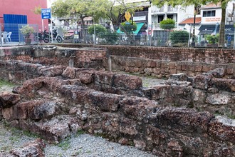
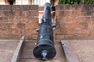
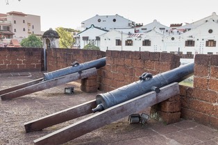
Here we have the Bastion Middleburg right next to the river.
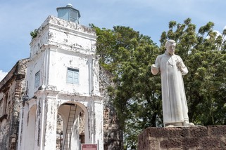
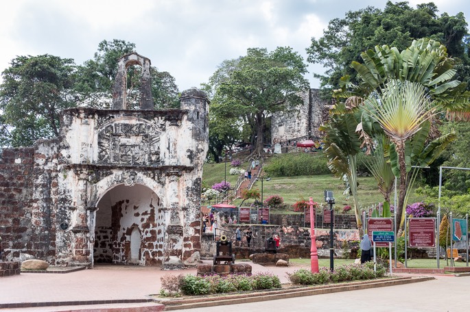
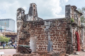
The Santiago Gate is the best preserved piece of the Portuguese fort, built in a hurry by Afonso de Albuquerque after he attacked and defeated the Melaka Sultanate in 1511. It changed hands many times but it was the British who ordered its destruction in 1806. But thanks to Sir Stamford Raflles and Captain William Farquhar, complete destruction of the fort and nearby buildings was prevented. Yet another example of people on the spot over-ruling commands from the British Government a million miles away!
Click here to return to The History of Melaka
Click here to return to Travels in Malaysia home page